SuperGPS – an upgraded solution of the GPS navigation system – extremely high accuracy with only a few centimeters error
- Tram Ho
GPS is a positioning system based on the position of artificial satellites, designed, built, operated and managed by the US Department of Defense. It has been an important technology for decades, but it has limitations, especially in urban areas where signals can be noisy. But now, engineers in the Netherlands have developed “SuperGPS” – a hybrid positioning system that combines wireless and optical connections to pinpoint locations within centimeters.

GPS is an age-old navigation system with many limitations.
Going back to GPS, each satellite of this system carries an atomic clock, allowing for extremely accurate time counting. This clock is synchronized with the clocks on the ground and on other satellites. A receiver can communicate with multiple satellites at the same time and calculate its own position in 3D space based on the positions of the satellites, with an accuracy that can be within a few centimeters.
But that’s under ideal conditions, and of course that’s not how the real world works. Buildings and various obstructions between the receiver (e.g. a smartphone) and the satellite can disrupt the signal and push the error distance to several meters. As location data becomes more and more important for future technologies, such as autonomous vehicles, it becomes increasingly important to find ways to improve accuracy.

Simulation of the SuperGPS system.
And that’s where SuperGPS comes in. Researchers from Delft University of Technology, Vrije Universiteit Amsterdam and VSL have developed an alternative system. It also works on the same principle as GPS but everything takes place entirely on the ground, relying on the exploitation of existing telecommunications networks.
The “satellites” in this case are wireless radio transmitters that will be scattered throughout an urban area. Instead of each requiring its own atomic clock to keep track of time, they are all linked to a single atomic clock via optical fiber, keeping the system in sync. It would then work like regular GPS, with receivers locating them by communicating with several radio nodes and calculating the time it takes for the signal to bounce back between each node.

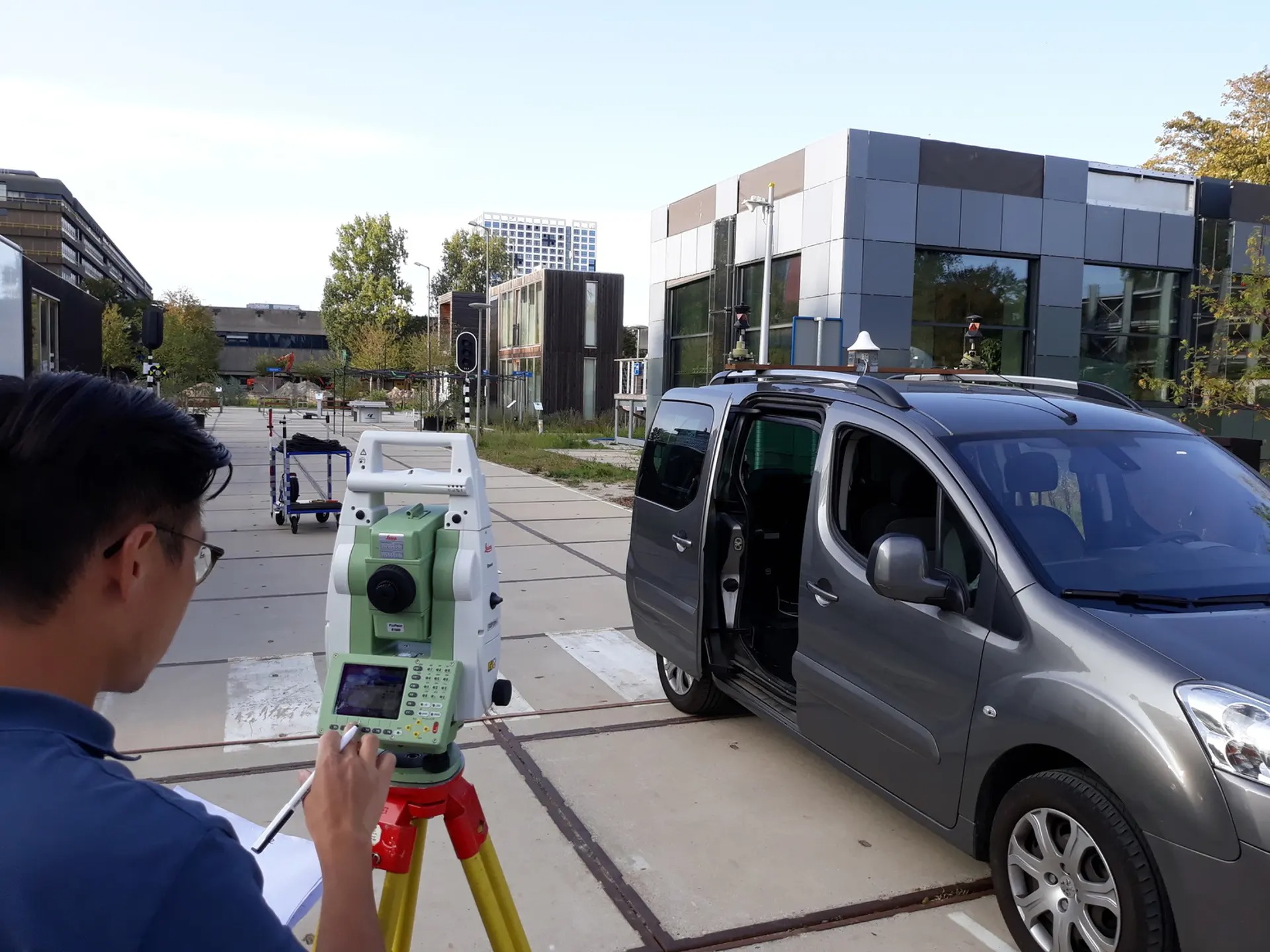
The SuperGPS prototype is being tested in practice.
The team says SuperGPS avoids the problem when buildings reflect radio signals, by using a “virtual” bandwidth made up of several smaller chunks of bandwidth. This produces signals similar to those used by cell phones, while allowing them to ignore the possibility of interference from buildings and other objects. In prototype tests of this system, the team says SuperGPS can track devices within a few tens of centimeters of error in crowded environments.
Of course, this type of system will not completely replace GPS, but the two can work in tandem to provide more accurate tracking in urban areas or provide a backup system in case of emergency. power-off.
The study was published in the journal Nature.
Refer to Nature, New Atlas
Source : Genk
