Deepfake map – Dangerous new type of Deepfake can sophisticatedly fake satellite images, experts fear security risks!
- Tram Ho
Deepfake technology, which has recently made a big splash thanks to its ability to replace human faces in videos that look cool but extremely dangerous, it is now able to modify satellite images and even create them based on regular map. So have you ever wondered why making such Deepfake maps is dangerous? And what will the development direction of this type of deepfake in the near future be like?
How AI falsifies satellite images
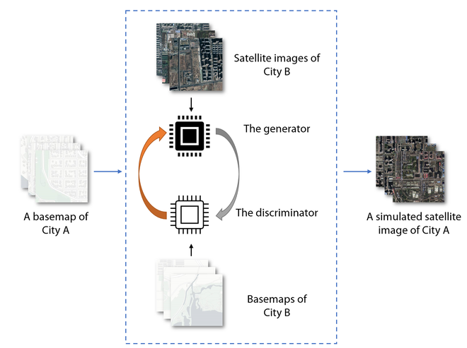
Diagram describing the nature of the neural network that generates deepfake tags | washton.edu
Deepfake is a learning machine-based technology that is capable of so “naturally” editing certain parts of a media file, such as replacing a face in a video, that the naked eye won’t recognize it. out these changes.
Enthusiasts and researchers alike experiment a lot with AI capabilities. So, recently, scientists from American University have found a new application of this technology, including creating satellite images artificially.
According to the authors of the neural network, it can find many uses. One of them is modeling a satellite image of a terrain that has not been captured in the past. This can help you understand how cities have evolved and how the climate has changed over the years. In addition, such a system can even help predict the future, so creating images based on existing ones can help meet many needs of world cartography, the main thing is that you must understand that this is just a model and you should not use it either. serious.
Why is Deepfake Map making dangerous?
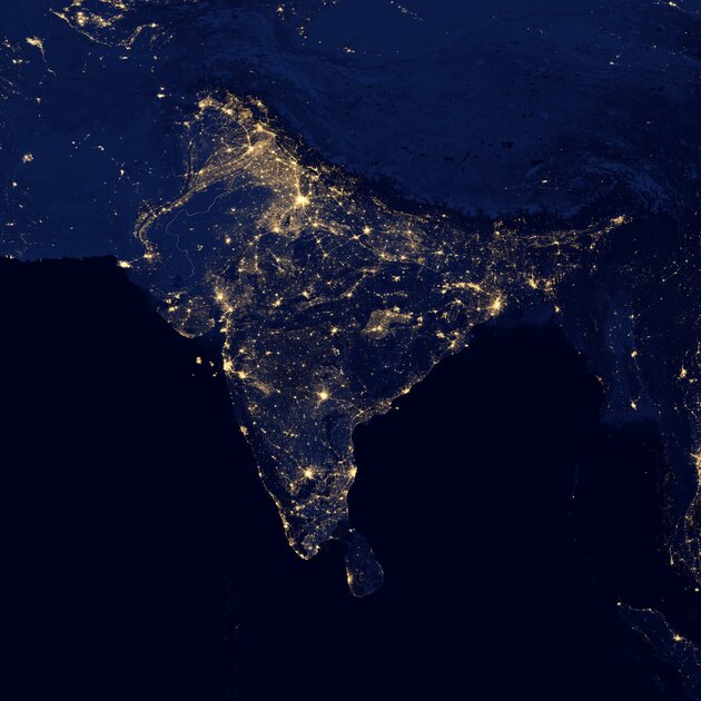
Recently, this photo went viral on the internet, but it turned out to be a fake photo
According to the authors of the neural network, they did not set themselves the goal of creating a tool that falsifies satellite images with a negative purpose. However, it should be understood that the possibility of changing the world map for personal, political or any other need, thereby misleading not only millions of people, but also national governments, is a rather serious threat to the security of many countries. Example: May contain wildfires and floods that do not exist in reality or may be related to recent political scandals.
For the average person, such poignant photos may turn out to be another fake picture appearing on the feed, but for someone who, for example, runs a business and is looking to invest his capital, which can become a serious problem, because he can be fooled by previously “correct” corrected maps. Of course, today or tomorrow you are unlikely to be affected by such a tool, but what if it continues to grow and eventually falls into the wrong hands?
Where did the development of Deepfake Maps begin?
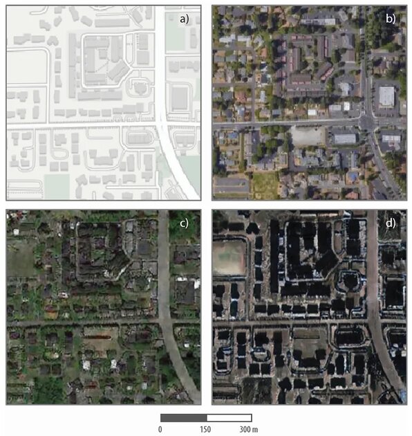
a, b – Tacoma region, used as input data; c, d – simulated satellite image based on Seattle (c) and Beijing (d) | washton.edu
The team of researcher Bo Zhao from the University of Washington were the first to adapt a machine learning system to create deepfake maps by uploading satellite images of three major cities around the world: Beijing, Tacoma and Tacoma. Seattle. These three cities have their own unique appearance, visible from the bird’s eye. So Seattle could be called greener, while Beijing, on the contrary, is more “concrete”. The neural network has learned to associate various details of a street map with satellite images.
So, as a result, the program has obtained a map of the part of any street and the indication of the city in which the processing will be performed. For example, in the photo above, you can see what Tacoma looks like with the architecture of concrete Beijing or verdant Seattle. You can also do a reverse generation and find out what the streets of Beijing would look like if trees were everywhere, like in Tacoma.
How can you tell which map is fake?
Obviously, it would be quite difficult for an untrained viewer to determine the difference between the real satellite image and the image processed by the neural network. For example, unrealistic colors, odd roof shapes, and unnatural shadows can be attributed to poor image quality. However, there are profound mistakes and logical contradictions such as streets leading nowhere and roads having no traffic. But let’s not forget that neural networks are constantly evolving and perhaps in the future we will no longer be able to easily identify where and where they are trying to trick us.
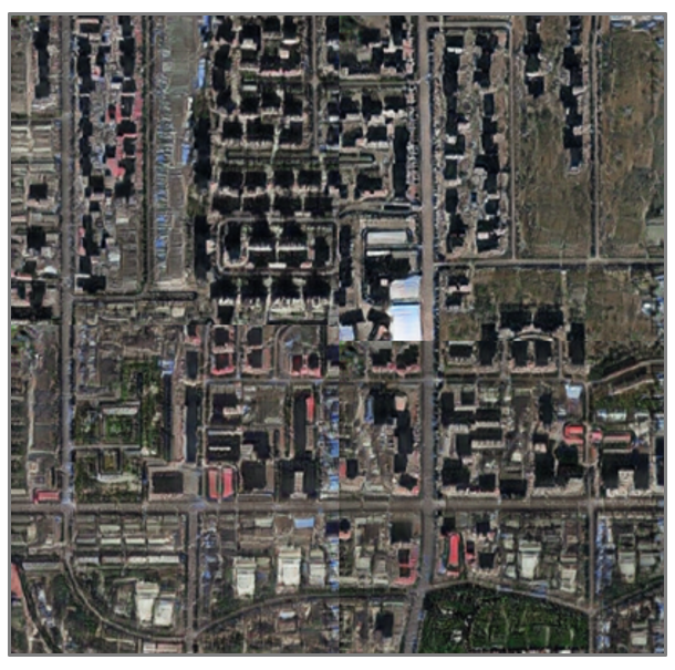
What may be an image of Tacoma is, in fact, a simulation, created by transferring visual models of Beijing onto a map of a real Tacoma neighborhood.
To accurately identify fakes, experts use color histograms and other deeply technical nuances of the images. Of course, both the construction of deepfakes and their search can be left to artificial intelligence. It is in the direction of neural network development that Bo Zhao’s team is currently working.
Deepfake Map Evolution
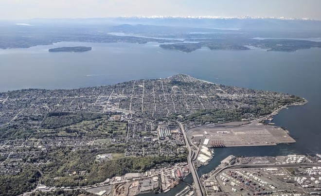
Aerial shot of West Seattle. Image: Dicklyon CCA-SA 4.0
The authors of the neural system that created the deepfake tag see a future for their offspring that not only develop directly, but also oppose it. Currently, both the enthusiasts and Bo Zhao’s team are working on a tool that is also based on machine learning and designed to identify fake cards. Of course, we have only seen the beginning of the evolution of geodata deepfakes and what will happen next can only be shown over time, but for now we can say for sure: Soon there will be fake satellite images and maps in one form or another into the everyday life of ordinary users.
“As technology continues to advance, this study aims to encourage a more holistic understanding of geographic data and information, so that we can shed light on the question of the absolute reliability of geographies.” satellite images or other geospatial data,” Zhao said. “We also want to develop a more future-oriented mindset to come up with countermeasures like fact-checking when needed,” he said .
The study’s co-author is Yifan Sun, a PhD student in UW’s Department of Geography; Shaozeng Zhang and Chunxue Xu of Oregon State University; and Chengbin Deng of Binghamton University.
According to Washington.edu
Source : Genk
